The Netherlands is experiencing a drastic decline in many butterfly species. In this article for the Dutch newspaper de Volkskrant, I designed graphics to show why this is happening, and illustrated many of the species that are experiencing habitat changes due to climate change and human influence.
For the article I made a slider map of the Netherlands in 1900 and 2023, showing how heathland (lavender), swamps (orange), and dunes (yellow) declined, while urban areas (blue) spread.
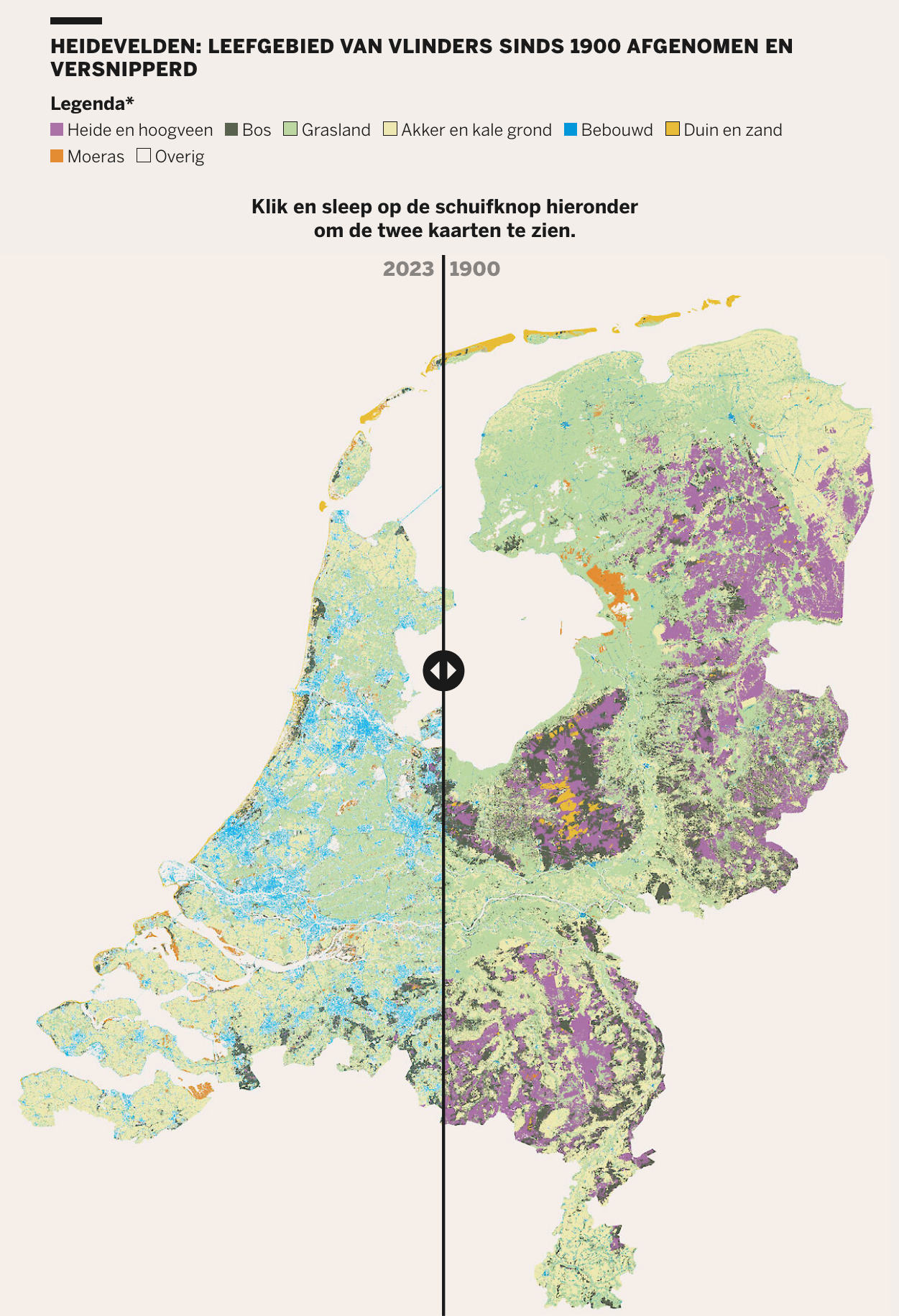
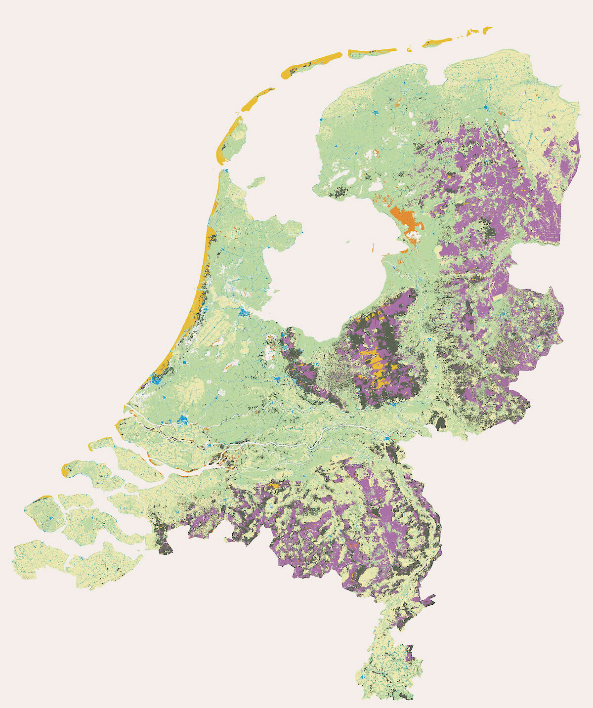
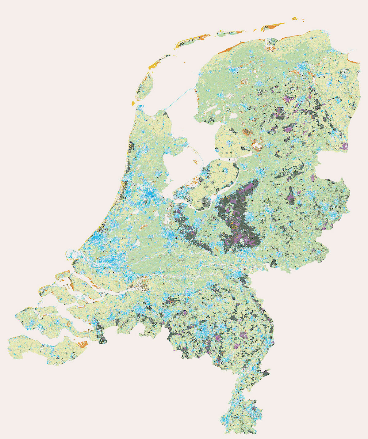
You can also see the huge changes made to the coastline of the Netherlands in the past hundred years, like the province of Flevoland claimed from the water (center of the map). Cartographically speaking, the Netherlands is a really unique and fun country to work with.
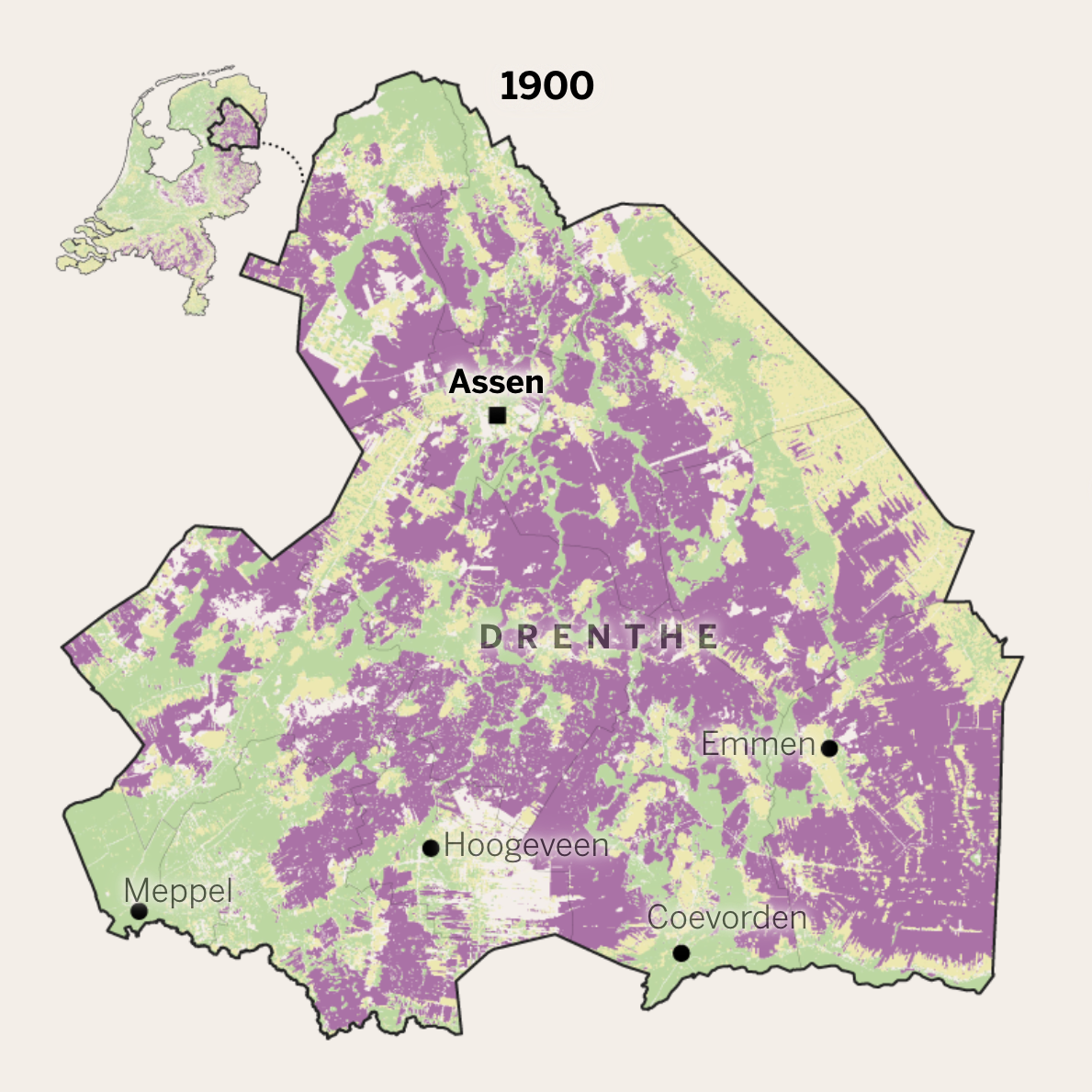
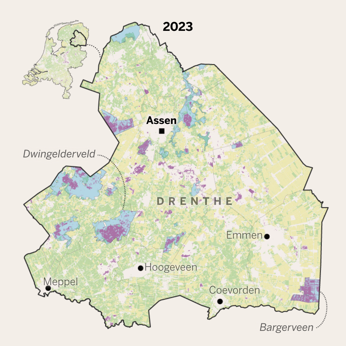
We also included a more in-depth map of the province of Drenthe, which used to have the highest percentage of heathland habitat (lavender). The remaining heathland today is now almost exclusively limited to the Natura-2000 protected areas (light blue).
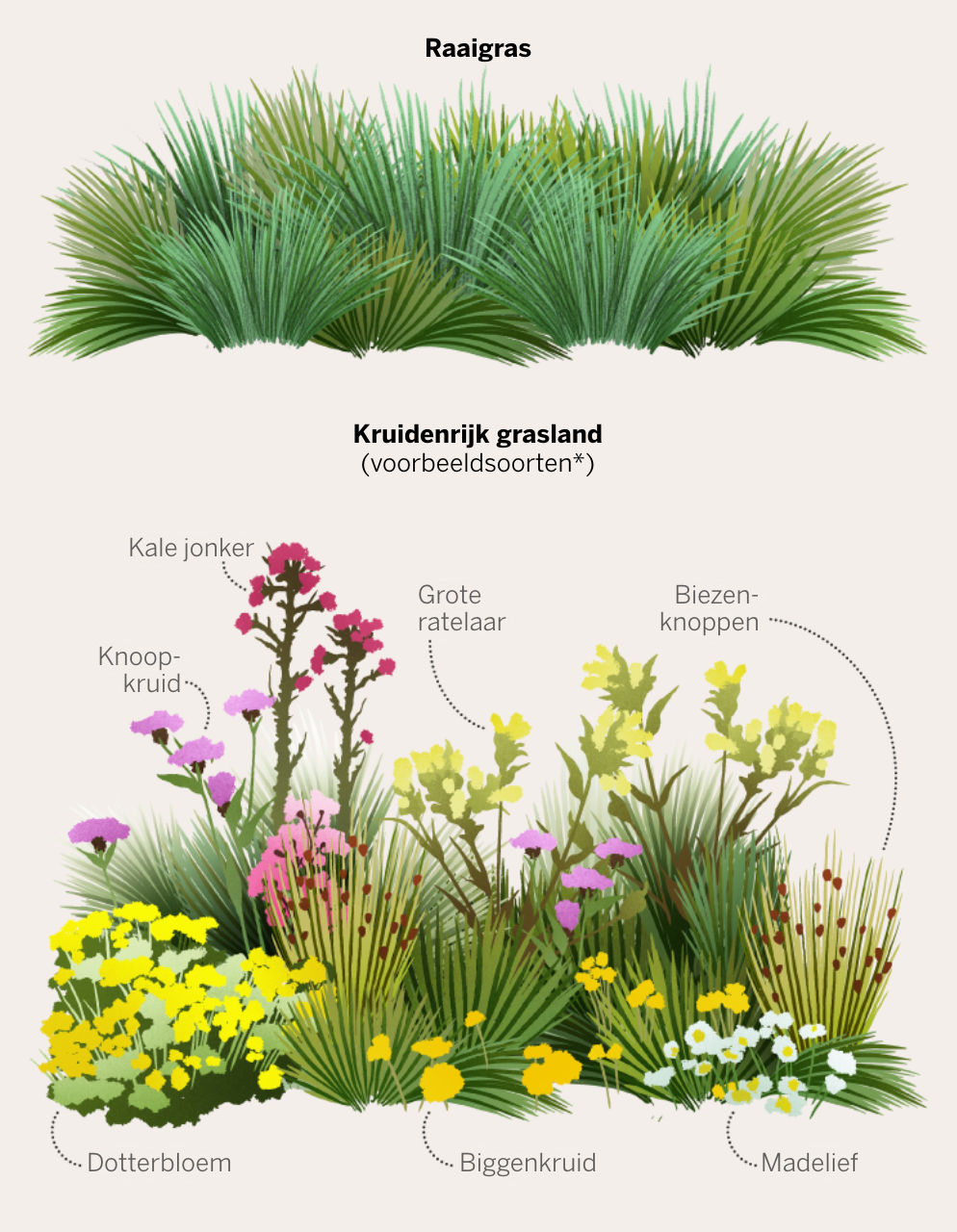
The illustration below explains how agricultural grassland, traditionally a large portion of the Dutch landscape, has changed through the years. Modern grassland for high-output beef and milk production (above), is very different from the species-rich grassland where cattle grazed a hundred years ago (below).
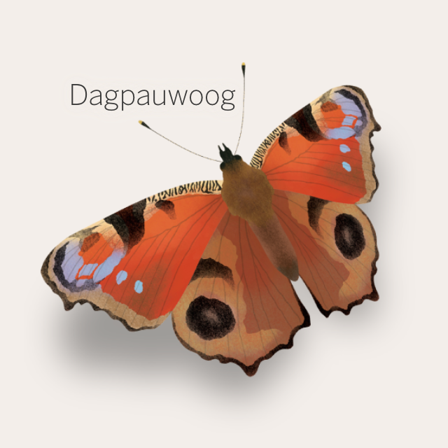
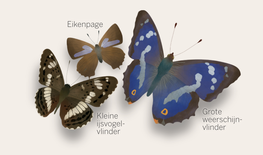
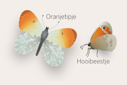
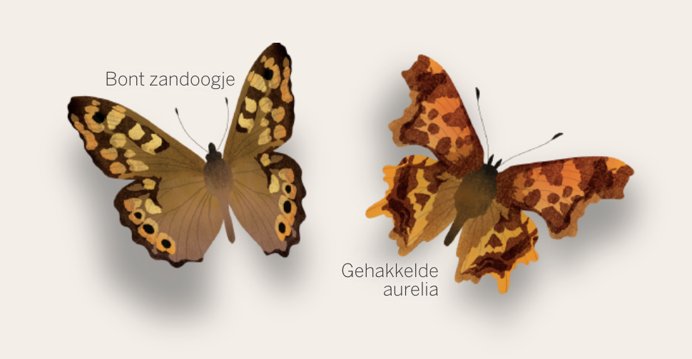
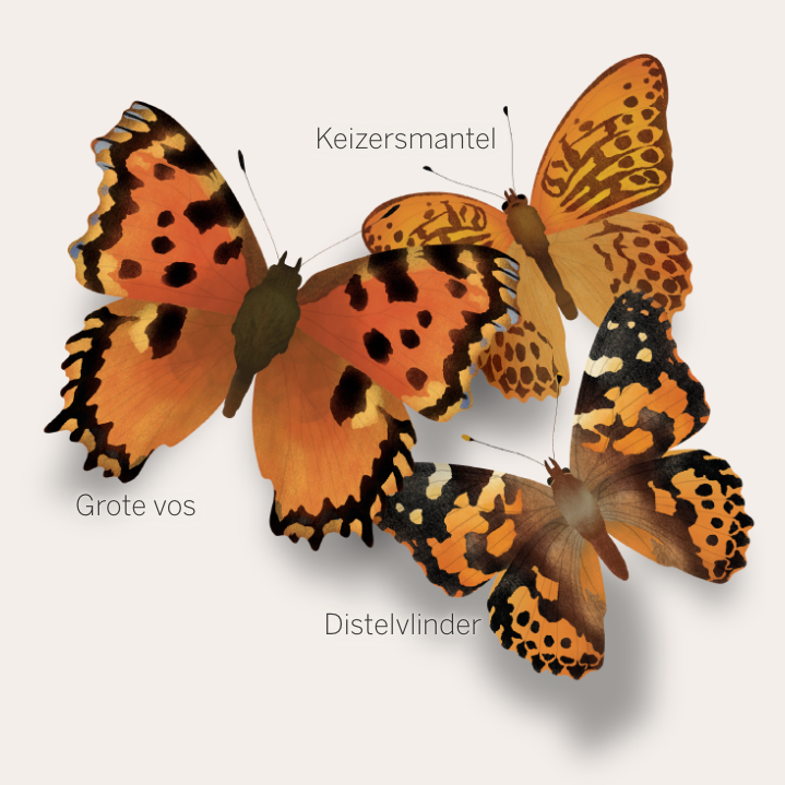
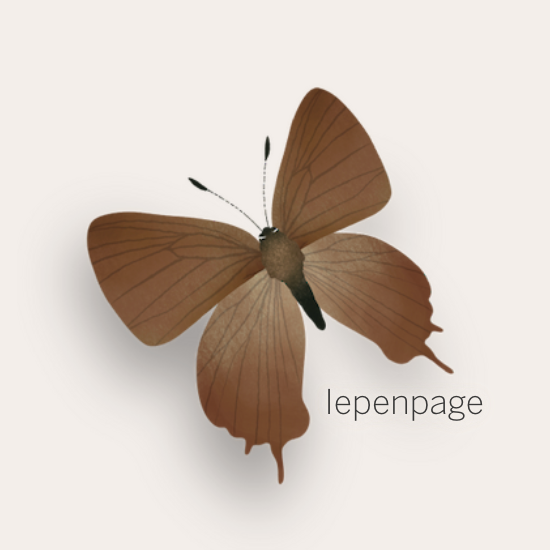
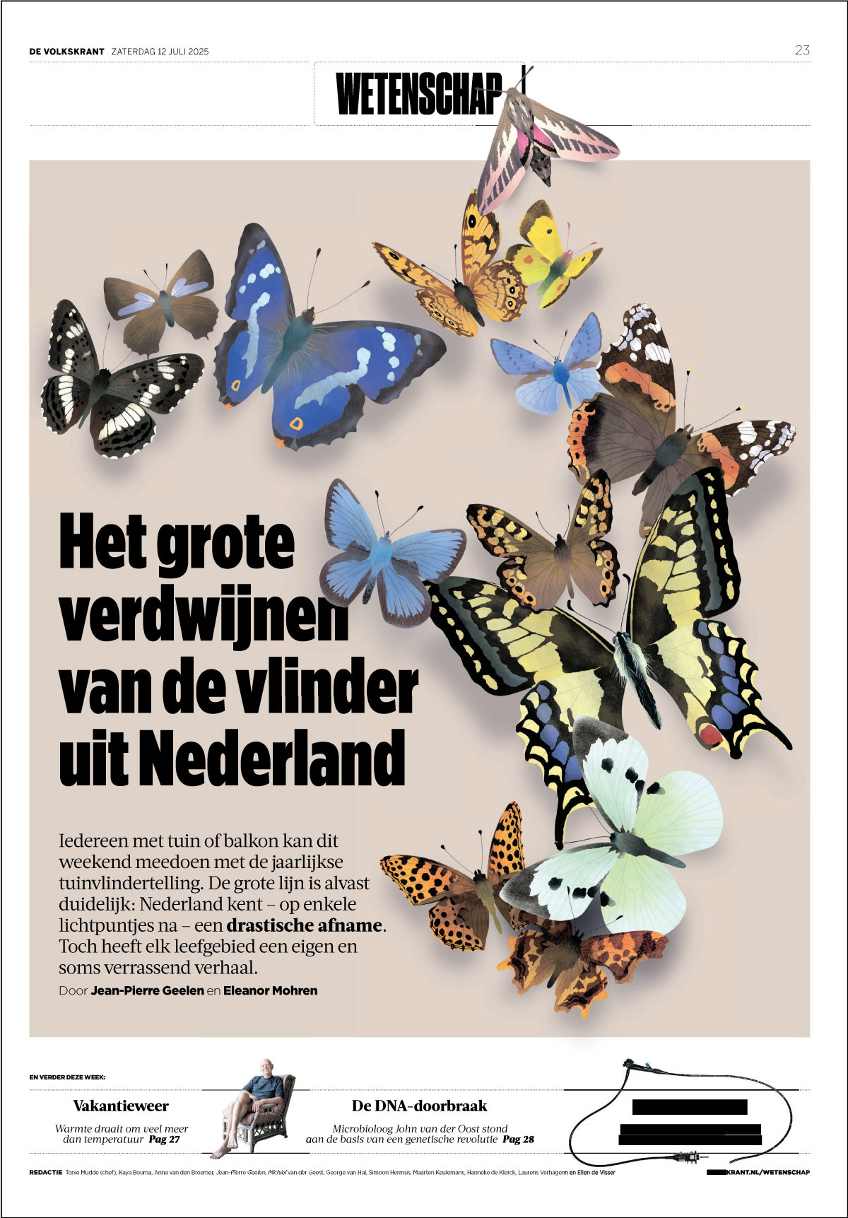
The article also featured many illustrations of butterfly species. These species were chosen to complement the different text sections that addressed each of the many different causes of habitat change and patterns seen in the environment.
The page design for the paper version was done by Tom Zaunbrecher.